CVM
Community Velocity Model Working Group
Working Group
Community Velocity Model

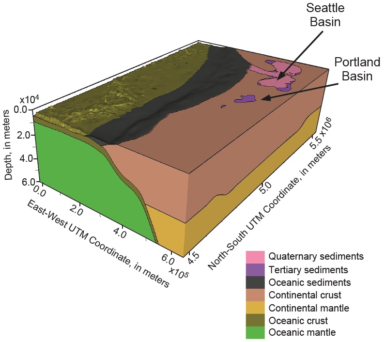
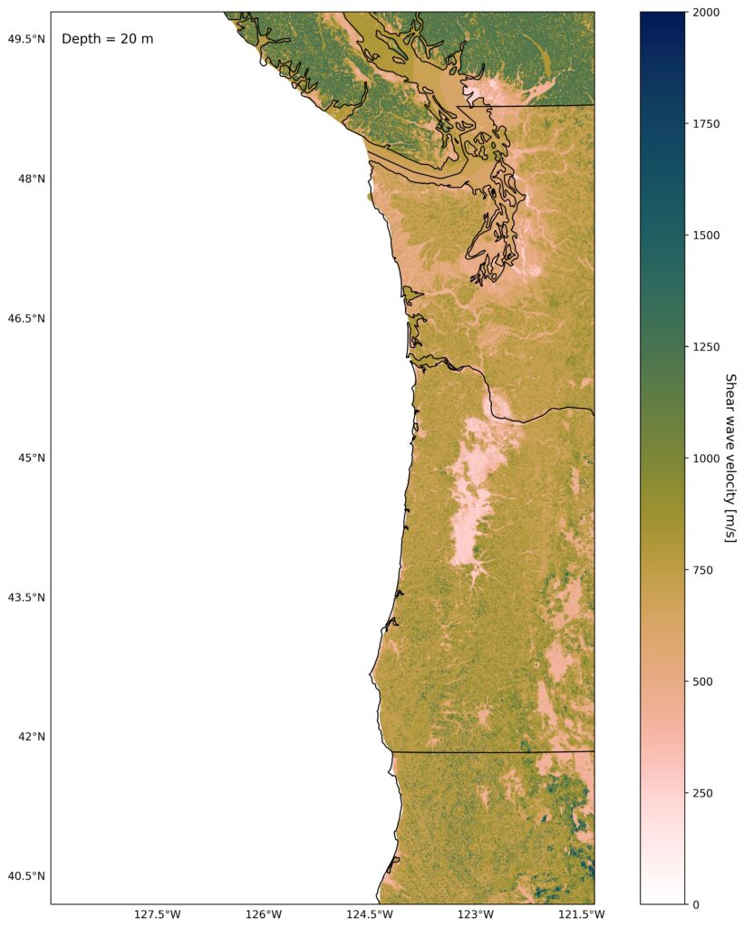
The Community Velocity Model (CVM) working group is constructing a three-dimensional representation of subsurface material properties for the Cascadia region. This includes seismic velocities (how fast seismic waves propagate) and densities (how stiff or consolidated material is). The model synthesizes existing information from the Pacific Northwest, including Northern California, Oregon, Washington, and British Columbia. These properties are critical to estimate the strength and other characteristics of shaking for future earthquakes in the Pacific Northwest, which plays a role in seismic hazard assessments. The CVM is a necessary input for the science of all other CRESCENT working groups and will be used by the broader community.
Major Activities
Timeline

Community Product
Community Velocity Model

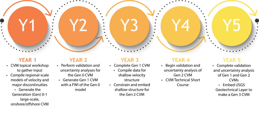
The CRESCENT CVM will be a three-dimensional, observational-empirical-structural hybrid model, with a large-scale regional base developed from inversions of seismological data, and shallow and geotechnical data embedded using geological constraints with empirical rock property relationships as well as near-surface seismic information. Spanning from Northern California to British Columbia, the various generations of the model will be available for CRESCENT-related science and community users in a variety of formats for common geophysical and modeling tools.
CVM Viewer
The CRESCENT Community Velocity Model (CVM) Viewer is a web-based platform for visualizing and exploring 3D models of seismic wave velocities and densities in the Earth. The viewer contains multiple published models of seismic wave velocities and will in future contain accompanying density models, relevant metadata, and supports filtering models by latitude, longitude, and depth. The viewer also contains interactive tools that allow the user to make model cross sections, depth profiles, and horizontal slices. The viewer displays the 3D spatial extent of the chosen velocity model, 2D surfaces such as subduction zone interface geometries, other regional crustal faults, terrain, geographic information, and seismicity providing spatial context for model analysis. The platform ensures seamless data integration by adhering to netCDF and HDF5 standards, with tools for data extraction, format conversion, and compliance checks. Users can download model data in multiple formats including CSV, geoCSV, netCDF, and HDF5.
The CVM Viewer is an open-source tool. Code is available on the CRESCENT Github.
Please reference using: https://doi.org/10.5281/zenodo.15015094
Meet The Team
CVM Membership

The CRESCENT CVM team combines expertise in multiscale observational seismology imaging techniques (e.g., ambient noise, teleseismic, and local earthquake data, and onshore/offshore active-source data) with expertise in ground motion modeling and the typical applications and uses of a CVM. We will collaboratively produce a community model that is useful and applicable to a variety of subduction zone science applications including dynamic rupture modeling, structural and geologic interpretation, and ground motion modeling.
alex grant
United States Geological Survey
agrant@usgs.gov
Emilie Hooft
University of Oregon
emilie@uoregon.edu
Erin Wirth
United States Geological Survey
ewirth@usgs.gov
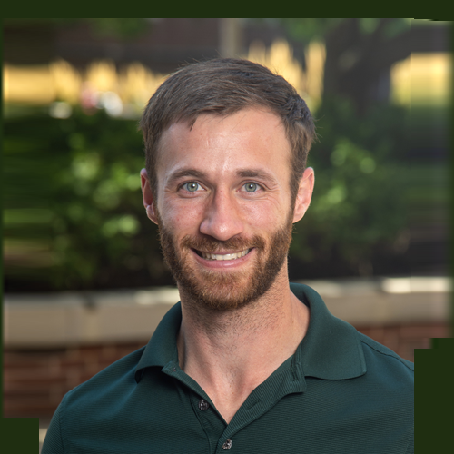
Jonathan Delph
Purdue University
jdelph@purdue.edu

Bin He
University of Oregon
binhe@uoregon.edu

Ian Stone
United States Geological Survey istone@usgs.gov

Rasheed Ajala
Columbia University rajala@ldeo.columbia.edu

Bill Stephenson
United States Geological Survey wstephens@usgs.gov


