
CPAL
Cascadia Paleoseismology Working Group
Working Group
Cascadia Paleoseismology

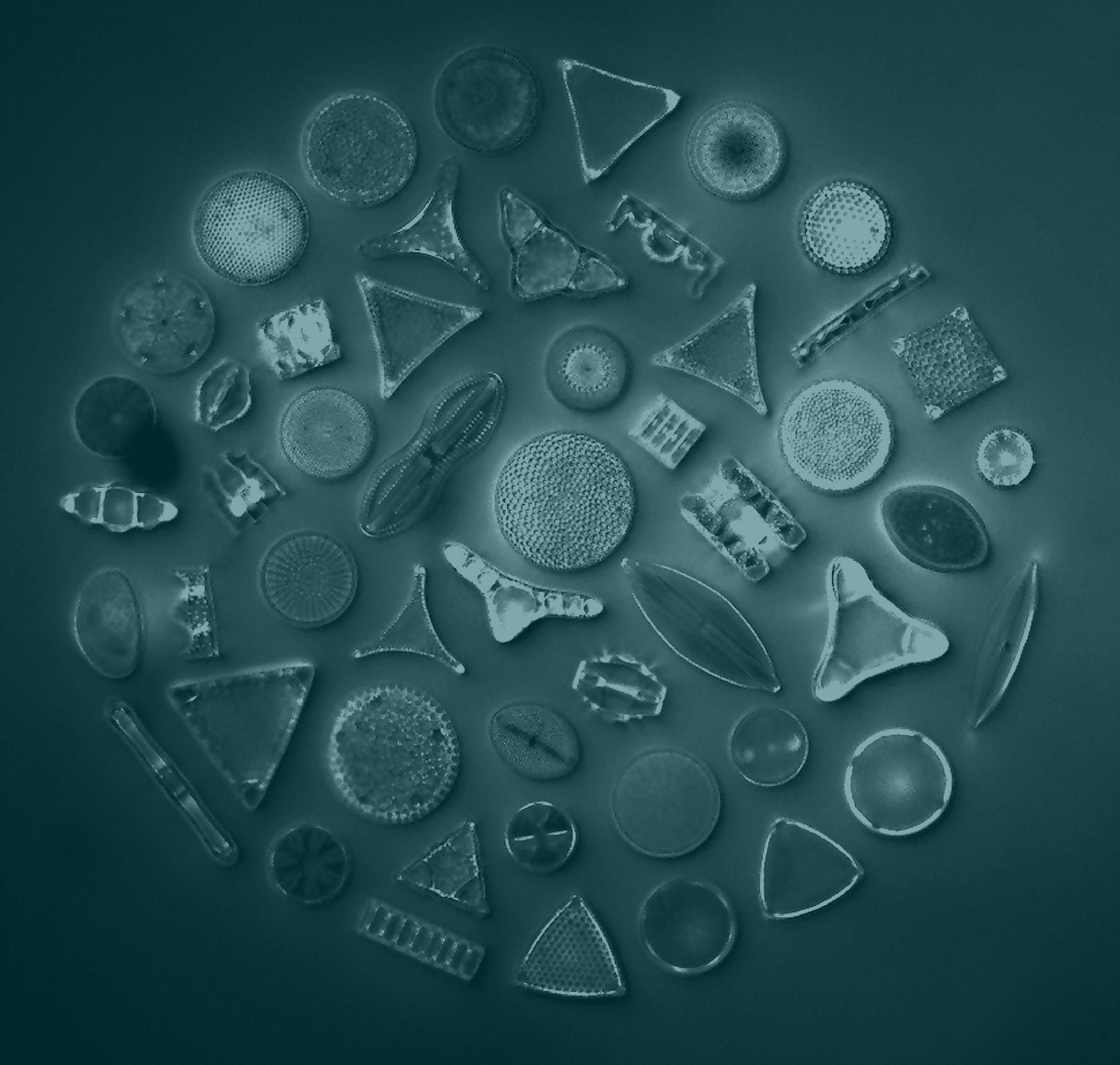
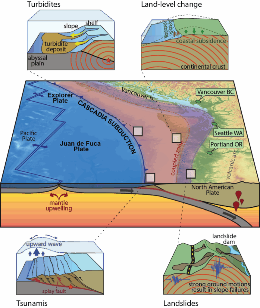
The Cascadia Paleoseismology Working Group (CPAL) will establish the frequency, timing, coseismic displacement, fault slip rate, and other diagnostic features that reveal details of past earthquake processes and can inform fault rupture models of past and future earthquakes in the Cascadia Subduction Zone. CPAL will build a community of practice that involves direct collaboration between paleoseismologists and modelers (e.g., the DET, CFM, and C3S Working Groups) with the goal of using paleoseismic data to validate numerical models of subduction zone earthquakes and tsunamis. CPAL will utilize detailed stratigraphic mapping, new methods and models in mapping, and high-resolution microfossil analyses to reconstruct coseismic land-level change and tsunami inundation during past Cascadia subduction zone earthquakes. Moreover, CPAL will promote investigations that examine interactions between the subduction megathrust and crustal faults.
(Photo Credit: Tina Dura)
Major Activities
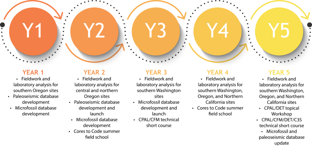
Timeline
Community Product
CPAL Viewer
The CRESCENT Cascadia Paleoseismology (CPAL) Viewer is a web-based platform for mapping, cataloging, and visualizing paleoseismic datasets associated with past earthquake evidence along the Cascadia Subduction Zone. The viewer allows users to filter by paleoseismic evidence type, location, quality of age control, and certainty of source mechanism. The CPAL Viewer is an open source tool. Code is available on the CRESCENT GitHub. The underlying dataset is from the Compiled onshore and offshore paleoseismic data along the Cascadia Subduction zone: U.S. Geological Survey data release, https://doi.org/10.5066/P13OJQYW.
CPAL database viewer doi: https://doi.org/10.5281/zenodo.15866114


PNAS Publication Highlight
Impacts of earthquake-driven subsidence
Led by Dr. Tina Dura, a team of CPAL Working Group members and collaborators assessed the real-world implications of earthquake-driven subsidence along the Cascadia Subduction Zone (CSZ). By combining geologic records of past earthquakes with numerical models of future subsidence and sea-level rise, the team quantified how flood exposure will evolve under different earthquake and climate scenarios. The work provides a framework for updating flood hazard maps and informing emergency preparedness.
The research was published in the Proceedings of the National Academy of Sciences Vol. 122 | No. 18: Dura et al. (2025): Increased flood exposure in the Pacific Northwest following earthquake-driven subsidence and sea-level rise. Dr. Dura also produced a plain language briefing document highlighting the key research findings, impacts, and considerations for practitioners and policy-makers.
USGS Cooperative Agreement
Research Project
A new two-year United States Geological Survey (USGS) cooperative agreement provides funds to support a paleoseismology-focused research project conducted by an integrated team at Virginia Tech, members of CRESCENT, and in close coordination with USGS scientists.
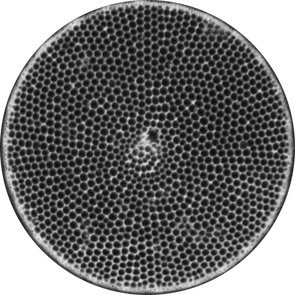
The Cascadia Paleoseismology (CPAL) Working Group and post doc will reconstruct vertical land-level change (VLM) across multiple earthquake cycles at key coastal sites in the Cascadia region using diatom-based paleogeodesy integrated with high-resolution radiocarbon and geochemical dating techniques. These reconstructions provide critical observational constraints on interseismic fault locking and viscoelastic recovery, informing the spatial and temporal evolution of strain accumulation along the megathrust.
We expect to incorporate the resulting paleoseismic VLM reconstructions and chronologies into next-generation rupture scenarios and tsunami hazard models, enhancing our ability to forecast coastal impacts and assess long-term risks for infrastructure, communities, and ecosystems in Cascadia’s low-lying coastal zones.
Meet The Team
CPAL Membership
The CPAL leadership team represents a broad spectrum of expertise in Cascadia paleoseismology. This expertise spans investigations of active crustal faulting, coastal tectonic subsidence, extent of tsunami inundation and composite earthquake histories of the Cascadia plate boundary and histories of upper plate faulting. The research tools used to collect and analyze paleoseismic data include excavations, coring, surveying, microfossil identification and employing both transfer function models and radiocarbon age models to refine-lab-derived microfossil observations and age determinations. The leadership team members individually, and collectively, mentor undergraduate students, graduate students and post docs. Paleoseismologists working within the larger CPAL research team will actively interact with the CRESCENT modeling community to ensure that paleoseismic data and tsunami inundation observations are effectively integrated with Cascadia deformation models.
Tina Dura
CPAL Lead
Virginia Tech
tinadura@vt.edu
Andrea Hawkes
University of North Carolina Wilmington hawkesa@uncw.edu

Bryan Black
University of Arizona bryanblack@arizona.edu
Lydia Staisch
United States Geological Survey
lstaisch@usgs.gov

Carrie Garrison-Laney
Washington Sea Grant
cegl@uw.edu

Harvey Kelsey
Cal Poly Humboldt harvey.kelsey@humboldt.edu
Eileen Hemphill-Haley
Cal Poly Humboldt
eileen.hemphill-haley@humboldt.edu

David Bruce
Virginia Tech
bruced@vt.edu