GEI Undergraduate Twinning Program
2025-2026 Students

Gigi Albers
Colorado School of Mines
Enhancing Pacific Tsunami Warning Center Operations Through Geospatial Data Analysis and Visualization

Mentors:
Jonathan Weiss, NOAA/NWS/Pacific Tsunami Warning Center
Helen Janiszewski, University of Hawaii – Manoa
Student Bio:
Gigi Albers is a second-year student studying Geophysical Engineering with a Hazards Track at the Colorado School of Mines, where she is also pursuing minors in Planetary Science and Mining Engineering. She recently interned at her institution with the Surface Water and Ocean Topography (SWOT) Mission, contributing to research on climate change and coastal systems. Gigi is a member of the Sigma Kappa Zeta Pi chapter, the Society of Student Geophysicists, and the Society of Women in Geoscience. Outside of academics, she loves hiking, baking, and unwinding with reality TV shows. Gigi aspires to a research-driven career in geohazards and planetary science, with the long-term goal of becoming a professor.
Project Summary:
This project involves working with scientists at the NOAA/NWS/Pacific Tsunami Warning Center (PTWC) and the University of Hawaii Department of Earth Sciences on enhancing visual representations of earthquake- and tsunami-related information that are used to guide decision making while issuing domestic and international tsunami message products. For example, one of many small projects the intern could work on involves modifying existing computer programs to create a new set of map products that show maximum tsunami computer model wave heights for coastal warning points in Cascadia. Another small project consists of creating maps and graphics illustrating time-varying seismicity around Hawaii and Puerto Rico.
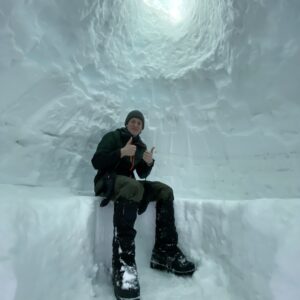
Dash Fitzgerald
Whitman College
Exploring linkages between larger-scale aseismic slow fault slip and accompanying smaller-scale fast seismic slip

Mentors:
Joan Gomberg, U.S. Geological Survey
Katheryn Materna, University of Colorado Boulder
Student Bio:
Dash Fitzgerald is a junior at Whitman College majoring in Geology and Computer Science. A first generation student, Dash works in his FGWC community to help broaden access to higher education. He also serves his community as a Wilderness First Responder and as a climbing instructor. In his free time Dash enjoys backpacking, climbing, kayaking, and playing music.
Project Summary:
This project focuses on understanding the various ways in which faults slip, particularly when at large-scale they slide so slowly that they are not considered ‘regular’ earthquakes and don’t radiate destructive seismic waves. These ‘slow slip events’ do seem to be accompanied by a tiny amount of ‘fast’ slip that radiates seismic waves that are observed as tiny overlapping ‘tremor’ signals or as swarms of distinct but small earthquakes. This project explores the connection between tremor and swarms and the larger-scale slow slip that is hypothesized to initiate or ‘trigger’ clusters of smaller seismic events. We will analyze data from both seismic and geodetic (e.g. GPS) monitoring networks for this exploration.
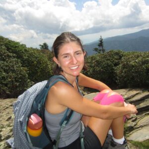
McKenna Ridgley
Miami University Oxford
Assessing and Sharing Risk with a Rapid Earthquake Damage Estimation Tool for the Cascadia Region of Western Canada

Mentors:
Mike Brudzinski, Miami University Oxford
Tiegan Hobbs, Geological Survey of Canada; University of British Columbia
Student Bio:
McKenna (she/her) is a third-year student at Miami University, pursuing a degree in Geology and Environmental Earth Science. She is passionate about exploration and eager to gain new experiences in a professional setting while making meaningful contributions. In her free time, McKenna enjoys being outdoors, hiking, music and spending time with family.
Project Summary:
The goals of this project are twofold: (1) to understand the potential impact of earthquake scenarios in the Cascadia region of western Canada and (2) to further develop tools to share this information with users in a timely fashion. The first goal involves modelling the hazard and risk posed by seismic scenarios in western Canada, using the methodology of the First-Generation Seismic Risk Model. Per the second goal, the results will then be communicated to practitioners and the public using the RiskProfiler.ca website. More importantly, the student will help to code a script to generate static products for a Rapid Earthquake Damage Estimator (RED-E) tool, similar to the PAGER and TwoPAGER products produced by the USGS. This will include a text-only product and a pdf product with maps and charts. Wireframes of these products were already developed by Patchett (2024), based on consultation with a wide range of practitioners, but have not yet been prototyped. The end product will be a catalogue of scenario events and a script to translate scenario results into usable information products for first responders and emergency managers. This will mark a significant step forward in understanding risk from future earthquakes in western Canada, sharing that information, and operationalizing a tool that will help practitioners best direct limited resources in the first 24-72 hours after a major earthquake.
Patchett, M. (2024). Characterization of End-User Needs to Optimize the Development of the Rapid Earthquake Damage Estimation (RED-E) System in Canada (Doctoral dissertation, University of Victoria).
Atiya Simon
The City College of New York
Quantifying infrastructure resilience to volcanic hazards in Cascadia

Mentors:
Einat Lev, Columbia University
Nathaniel Klema, Fort Lewis College
Student Bio:
Atiya is an Earth System Science and Environmental Engineering student at The City College of NY. Her educational focus is on environmental engineering with an emphasis on climate and resilient infrastructure. Atiya is interested in geotechnical systems, hazard modeling, and climate smart design solutions for vulnerable communities. Atiya has a passion for climate-smart design and community resilience. In her free time, she enjoy spending time with family, riding bikes, going to live performances and watching sci-fi tv and movies.
Project Summary:
This project will develop a formal educational collaboration between the Lamont-Doherty Earth Observatory (LDEO) and the Engineering/Applied Physics department at Fort Lewis College (FLC), which is an MSI identified as a Tribal Serving Institution. The work will leverage existing tephra dispersion models accessible through the VICTOR project by using model outputs for potential eruptions of high-threat volcanoes in the Cascades subduction zone as initial conditions for assessing structural stability and resilience of infrastructure in surrounding communities. A student with a background in structural/civil engineering or physics will learn to identify vulnerable structures and generate load maps for a range of eruption scenarios. Scenarios will be informed by the current understanding of potential eruption behaviors at South Sister, Mount Hood, Mount St Helens, Mount Adams, and Mount Rainier. In addition to providing access for an FLC student to the expertise and resources available at LDEO, this project would expose the student to interdisciplinary research that connects volcanology to civil/structural engineering, thus increasing the societal impact of open-source volcanology codes and the VICTOR platform.
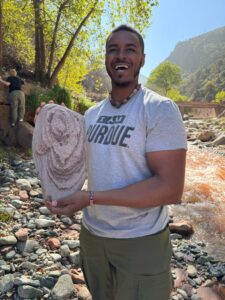
Cayden Woolery
Purdue University
Earthquake detection using machine learning tools in the Valles Caldera, New Mexico

Mentors:
Urbi Basu, New Mexico Institute of Mining and Technology
Akram Mostafanejad, EarthScope Consortium
Student Bio:
Cayden is a third-year undergraduate student at Purdue University, majoring in Geology/Geophysics and Planetary Science, and minoring in French. His focus lies mainly in the sphere of geophysics with a passion for seismology, vulcanology, and hazard detection. At school, Cayden takes pride in being an ambassador for the College of Science, the Multicultural Science Program, and the Earth, Atmospheric, and Planetary Department as he strives to ensure that every student- regardless of background or identity- has a voice on campus and in the greater scientific community. In the future, he hopes to work as seismologist and/or vulcanologist for USGS. Outside of academics, Cayden enjoys hitting the gym, hiking, watching a good movie, and hanging with friends.
Project Summary:
The Valles Caldera, located in northern New Mexico is a resurgent caldera with a central dome. The perceived lack of seismicity in the Valles Caldera has been attributed to elevated crustal temperatures inhibiting brittle failure (House & Roberts, 2020; Sanford et al., 1991), however sparse availability of seismic data in this region has made earthquake detection further difficult. Thus, in the absence of a seismic network, local and microseismic events within the caldera may remain undetected. Studying the microseismicity of the caldera is very important as it would help us accurately evaluate the seismic hazard risk of the region and its impact on the nearby cites and structures, it will provide key insights on the geometry (dip and shape) and extend of active faults in the study area and further understanding of the hydrothermal processes associated with the Valles Caldera. Recent temporary seismic installations of three channel 5Hz nodes and broadband stations during the Summer of Applied Geophysical (SAGE) summer campaigns of 2019 and 2022 have revealed microseismicity in this relatively aseismic volcanic region. The intern will use machine learning techniques to investigate microseismicity in the Valles Caldera using the six broadband stations installed for a period of around four months (June-mid October) in 2023 and 2024. The project will utilize automated machine learning tools to detect any seismic activity in the Valles Caldera. The research will mainly consist of three steps: (1) seismic P and S wave phase detection using automated seismic phase EQTransformer (Mousavi et al., 2020); (2) phase association and initial event location using rapid earthquake association and location method (REAL; Zhang et al., 2019); and (3) initial 1D earthquake location using absolute location algorithm VELEST (Kissling et al., 1994). The initial analysis will be done with two months of data from the six broadband stations for year 2024 and then expand the processing with all data available from 2023-2024.

